| ::CURRENT TIME:: |
|---|
| -- Q.O.D. -- |
| -- l i n k s -- |
| :: portland'5 centers for the arts [>] |
| :: team oregon m/c training [>] |
| :: slashdot [>] |
| :: sluggy freelance [>] |
| :: snoopy's doghouse [>] |
June/July 2006 trip around the USA
WEEK ONE WEEK TWO WEEK THREE WEEK FOUR
Day 8 - June 17, 2006
Departure time: 0730 EDT
Departure City: Dunmore, Pennsylvania
Departure Mileage: 3397.3
Arrival time: 1755 EDT
Arrival City: Amesbury, Massachussetts
Arrival mileage: 3720.7
Day 8 mileage: 323.4
Click here for a Google Map showing my progress to date
(thanks to my friend Glen for coding this up in his spare time)
Week two begins by getting back in to New England. For the very first time on this trip, I got wet. It rained fromo about the time I entered Orange County, New York until just about Great Barrington, Massachussetts. The clouds were very low and the scenery was pretty much invisible today, so not many pictures of this very pretty part of the country.
Near Great Barrington, Mass., I came upon a house that looks like it hasn't been lived in for a while

Today, I managed to stay off the interstates for most of the day after leaving I-84 eastern Pennsylvania. The Taconic State Parkway in New York took up a lot of the morning. I also suddenly remembered what it's like to drive back east when I encountered, to my surprise, a toll road ... and me without more than about three bucks in my pocket. I paid the toll and then a the next gas stop took out some cash from a handy ATM so I could pay further tolls. I hate paying tols on a motorcycle. Do it more than a couple of times and you quickly understand the attraction of the EZ-Pass and other electronic toll collection devices available in these parts for regular travellers.
There was some great riding in New York and western Mass. I let the GPS do the navigation and it took me over what seemed like every tiny county road in eastern New York and a bunch of the ones in western Mass too. Route 23 is where the two pictures in today's post come from.

Alongside the road near Otis, Massachussetts
Aside from the crack sealant (which at times was more prevailent than the pavement) Route 23 is a wonderful piece of pavement with plenty of nice curves and little traffic.
I had a wonderful visit with Mark and Amy in Westfield and Amy pulled together a terrific lunch for us all. We had a good time with the pups and catching up. Then it was off to Amesbury where I will hang for at least a day before heading up to mom and dad's place in Maine.
That's all for today. Short day, short riding time, rain and low visibility made for not many picture taking moments. So, I went for quality in the absence of quantity.
Day 9 - June 18, 2006 ... Rest day
Departure time:
Departure City:
Departure Mileage:
Arrival time:
Arrival City:
Arrival mileage:
Day 9 mileage: Zero on-bike miles today
Click here for a Google Map showing my progress to date
Today was a rest day. No motorcycle travel today. Glen and I headed out for some car sightseeing and a nice seafood lunch by the water up in Kittery, Maine. Otherwise, this nice, warm late spring Father's Day is a good day to relax and just veg for a bit. I'll be off to Maine tomorrow sometime.
Day 10 - June 19, 2006
Departure time: 0945
Departure City: Amesbury, Massachussetts
Departure Mileage: 3720.7
Arrival time: 1535
Arrival City: Union, Maine
Arrival mileage: 3879.2
Day 10 mileage: 156.5
Click here for a Google Map showing my progress to date
Wow, am I back on the east coast. The TV weather people call this "Hazy, Hot & Humid" around here - "The Three H's". The vinyl window on top of my tank bag literally fogged up when I brought it out of the house and put it on the bike. My envelope of gasoline receipts is limp and wilted, soggy and soft. I pull all of my gear on, but I long to get moving quickly and get air moving through the vents.
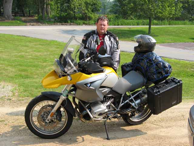
Last bits of packing and getting ready. Time 9:45 AM. Temp mid 80's. Humidity high 80's. Ugh.
(Photo by Glen Salmon)
Once I got on the road, the breeze through my jacket was very nice. I slabbed it up the short distance through the New Hampshire portion of I-95, paying one toll on the way - $1.00, and moved on toward the border of Maine.
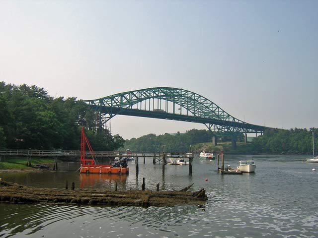
Piscataqua River Bridge that crosses between NH and ME on I-95.
I paid another toll at the entrance to the Maine Turnpike - $1.50 - and continued up the turnpike in the steadily warming weather. By about 10:45 or so, I had reached Portland and decided to stop in to see my friend Mike who works at Time Warner Cable in South Portland. We had a nice visit and went out to Ruby Tuesday's nearby for lunch. Afterward, I spent some time taking a few pics around Portland before heading north.

Hazy day over Portland, Maine.
The seabreeze was nice in Portland. It cut through the sticky weather very well and made it bearable.
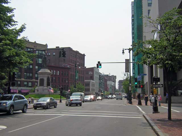
The "main drag" through downtown Portland - Congress Street. To the left, you can see the Solider's Memorial in Monument Square.
A group has been working on restoring the old St. Lawrence Congregational Church up on Munjoy Hill

This is just around the corner from an apartment I occupied here for a couple of years.
I headed up to the Eastern Promenade (The Eastern Prom to locals) to see what the view over Casco Bay looked like on this hazy day. Happily, the seabreeze had cleared things out a bit over the water.
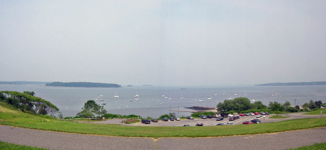
Casco Bay viewed from the Eastern Prom
The Eastern Prom was the last stop in Portland. Now, I was northbound again, not to stop until I got to my mom and dad's driveway. Mom had written a few days earlier and mentioned that route 226 out of Gardiner was all torn up with construction, so I let the GPS route me around that. It became clear that the unit doesn't know (or care) what type of road it routes me on to. Since I know my way around this part of the world, and could bail out of any silly routes the box put me on, I decided to trust it and let it do the thinking for me. Well, I though I knew all the roads in the area. I didn't. At one point, the GPS tells me to turn left - but left is what looks like a farmer's driveway. The map confirmed that there was another road a couple of miles ahead that I was being directed to, but in the meantime, I turned on to this nice, flat sand and gravel road.... which became a rough and mangled hardpack sand road .... which became a rutted, grass covered, pothole strewn gravel and earth road ... which became a path through the trees just barely wide enough for something the size of a Mini-Cooper. Just as I was getting ready to power out in to the trees and turn around, the little GPS voice came up and said "in point 3 miles, turn left" ... and sure engough, I pop out from the tree line and right on to a freshly paved state highway.... just like the map said I would.
So, now I know a new shortcut.
Finally, around 3:15, I crossed the line in to Union.
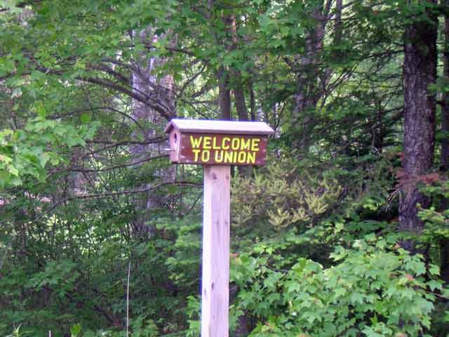
The Union, Maine trademark birdhouse road markers
Union is a special place to me. It is the place where I always had a childhood available. It is the one place that's been consistent throughout my life and through all the moves, job changes, school, etc. It's a little town of roughly 1500 and I'm fairly certain the dairy cows outnumber the people.
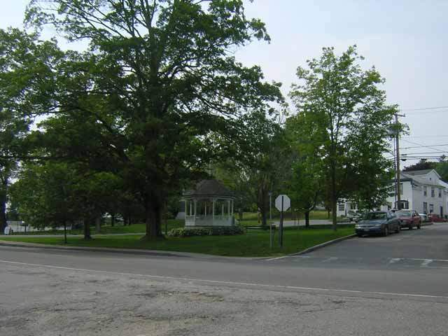
This is a quick shot of the bandstand in the Common.
I pulled in to mom and dad's driveway at about 3:30, unpacked the bike got in to my swim trunks and went and jumped in the lake.
This evening, we all went up the road and visited with an old family friend at her camp on Crawford Pond. Yup, it's quiet, it's dull, it could even be called boring. In other words, it's a perfect way to relax.
More to come. Meanwhile, there's a piece of pie over there in the kitchen with my name on it.
Day 11 - June 20, 2006
Departure time: 0945
Departure City: Union, Maine
Departure Mileage: 3879.2
Arrival time: 1335
Arrival City: Union, Maine
Arrival mileage: 4048.6
Day 11 mileage: 169.4
Today was an exploring day. Just a few hours, just a few miles, but I rode some roads that I'd never been on before and found a couple new shortcuts.
I left Union a little before 10:00 with the intention of simply heading in a generally "north" direction from the house to see where I'd end up. The first thing I did was to explore a road that on the map goes all the way over Barrett Hill, but at the end of Barrett Hill Road, there is a "Dead End" sign.
Turns out it's not a dead end road. It does, however, turn from asphalt to dirt fairly quickly and from dirt to ruts a short time after that. So, maybe it IS a dead end road ... depending on what kind of vehicle you're traversing it with.
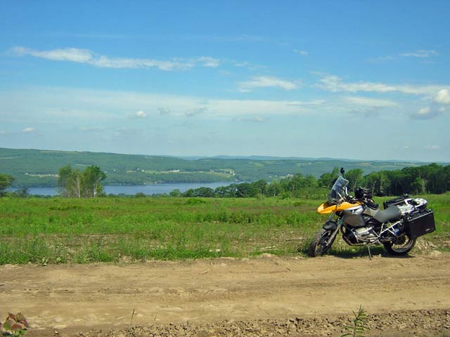
Atop Barrett Hill with Crawford Pond in the background. This was the really nice high speed portion of the dirt road.
After popping out the other side and heading once again in the general "north" direction, I found myself in a tunnel of trees near
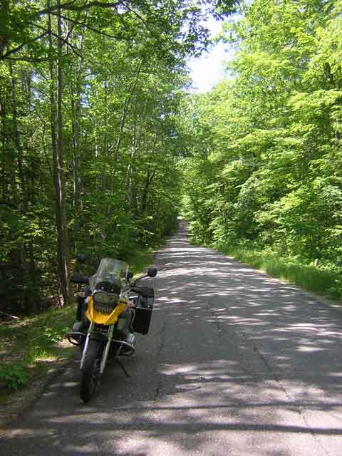
Along an unnamed road near Whitefield
This little road connected between two state routes and had semi-poor pavement, but it was shady and cool and a certain level of mild twistiness was offered.
I kept heading as "off the beaten path" as I could and next found myself lerning what the little dotted line roads on my GPS map mean...
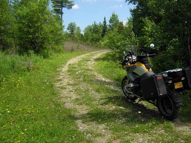
This road went through to the other side after roughly 17 miles and passed three small houses along the way. I couldn't help think that it was just a really long driveway, but it connected to two other roads, wasn't posted as "private", and showed up on the map. I think that qualifies as a road.
The roads in this part of the state are, as far as I can tell, all built on top of what used to be wagon tracks and cow paths from town to town. There is nothing like a road grid and the roads simply go where they're needed as directly as possible. Of course, this is the story in most of New England, actually, not just here. Farmer A needed to get from his place to town in the shortest possible distance and so just created a beaten down path in the grass. Farmer B uses a different path to town. Farmer C sort of follows part of farmer A's but cuts a little of his own path. Eventually, they all become roads and they pretty much go where the old farmers first went maybe 150 years ago.
Because of this, the roads around here are two things - mildly twisty and fairly unpredictable. Pavement conditions vary with the town and the budget available for maintenance. But here and there, you get to experience some amazing sets of linked turns one after another after another.
I discovered that I was indulging my dirt and trails fetish today though, so in between the twisties, I had to head off and do some more exploring.
At one point, I come across a powerline right of way. Around these parts, the ROW's aren't fenced off and they get used regularly for ATV and Jeep travel, hunting, trapping, etc. I came across one about 30 miles outside of Augusta and decided to check it out. The map said that there was another regular road about 4 miles directly east of where I had stopped at the power lines. It appeared that the ROW ran between this road and that one, so I headed up the hill along the ROW.
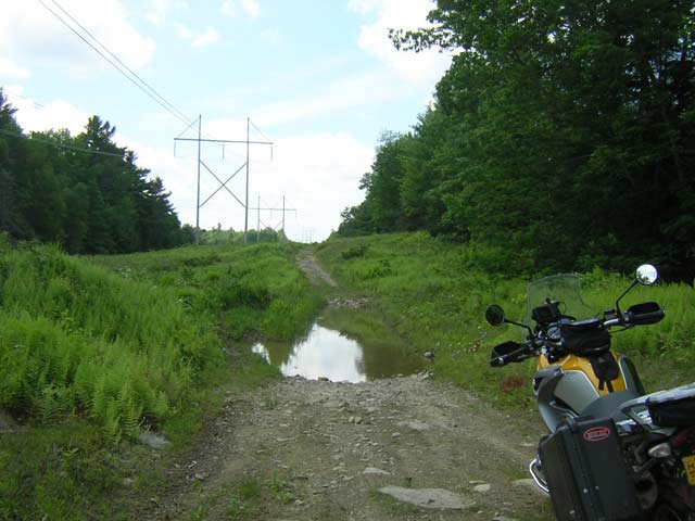
This was a moment to stop and find a stick or something to check the water depth ahead. I had come through several medium to large puddles and wet muddy areas, but with this one, the bottom was invisible. Sure enough, when I pulled a branch out of the woods and stuck it in the water, this "puddle" was roughly 3 feet deep in the middle. Being out by myself, 3000 miles from home and about 3 miles up this ROW, I decided that discretion would be the better part of valor on this one and I wasn't going to risk breaking or drowning the bike. I found a semi-solid track just to the left of the big puddle and only went in to water about a foot and half deep. My cylinder heads wnet under for a moment, but nothing else and I came out the other side fine, continuing up the ROW for another 2 miles or so to the next road.
The next road, however, turned out to be yet another unpaved country backroad
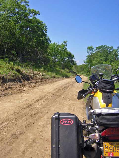
Country road near Albion, Maine
The road was fairly well maintained with only the occasional giant chuckhole and made for a pretty fun ride for about 20 miles or so. It popped out in the middle of the village of Albion and it was about time for gas and a late lunch anyway, so I made a detour to the Albion general store and Texaco station.
After the break, I decided that it was time to head back, so I let the GPS do the driving to get me back to Union. Once I got back on roads I knew, I shut the nav system down and headed up Clary Hill road to see what the visibility was like today.

'Twas a beautiful day in the mid-coast region. This is the top of Clary Hill looking toward Hope and Appleton.
I made an attempt at coming down the backside of Clary Hill on the old Stone Road, but it had washed out too badly in the recent bad rains here. I got about a mile down it and ran in to an insurmountable washout that would have completely swallowed me and the bike if I had continued. So, it was time to turn around and head back up the hill and go round the pond to the house.
The ride made for a nice break and a nice way to spend a few short hours on some of the more interesting backroads in Knox and Waldo counties.
That's all for today. Tomorrow morning will probably be a short coastal ride and then on Thursday I plan to head over to Mount Washington to ride up the auto road. More to come.
Day 12 - June 21, 2006
Departure time: 1050
Departure City: Union, Maine
Departure Mileage: 4048.6
Arrival time: 1410
Arrival City: Union, Maine
Arrival mileage: 4132.2
Day 12 mileage: 83.6
Before I start the report for today, I have to share one more picture from last night. We had a line of pretty heavy thunderstorms rip through here about an hour before sunset. By the time sunset rolled around, the clouds were justs starting to move off to the east and we were treated to a spectacular purple sunset under the storm clouds:

Just a short local jaunt today around Owls Head, Rockland, Rockport, Camden and Megunticook Lake.
Another beautiful day in mid-coast Maine. Not too hot, not too cool. A lot of people visiting the beaches at Owls Head and the lakes.
The day started with a quick run straight in to Rockland via route 17. Cruised through the south end and over to Owl's Head, around the airport in to South Thomaston, then back in to Owl's Head at Crockett's Beach.
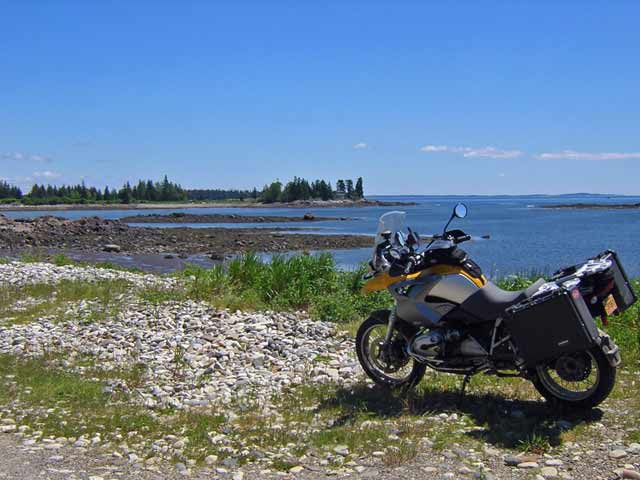
Along Crockett's Beach in Owls Head
Then it was a short ride along Balyhoc Road down to Dyer Point. This is one of those roads that is paved nicely, has no center line, a speed limit of 45 MPH and virtually no traffic on a weekday morning. In other words, a fun ride.
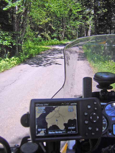
Along Balyoc Road in Owls Head
I stopped for lunch at the Owls Head General Store and then continued on in to Rockland, then up the coast to Rockport.
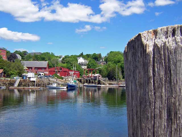
Part of Rockport Harbor
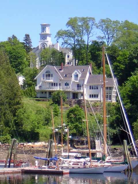
Another piece of Rockport Harbor
Rockport was one of the centers of the limestone trade 75-100 years ago. Next to the Marine Park downtown are the remnants of two lime kilns and one of the old locomotives that were used to move the limestone from kiln to kiln.
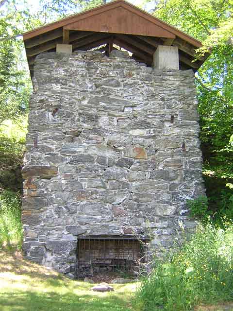
Lime Kiln in Rockport
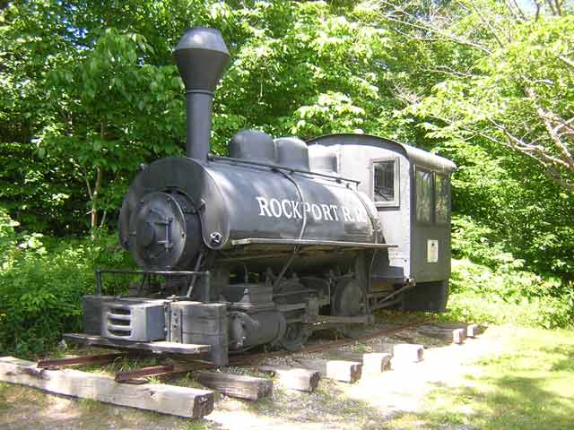
One of the old Limestone locomotives
In the pakring lot, a classic Maine Democrat was displaying his opinion

Left leaning bumper sticker on the right bumper....
After leaving Rockport, I cruised through camden without stopping. I had come in on the back roads, but I spotted three tour busses up on route one unloading people for shopping and whatever else they do. Not a good moment to stop in Camden and play tourist.
Headed out of Camden via route 52 up past Megunticook Lake and in to the Camden Hills
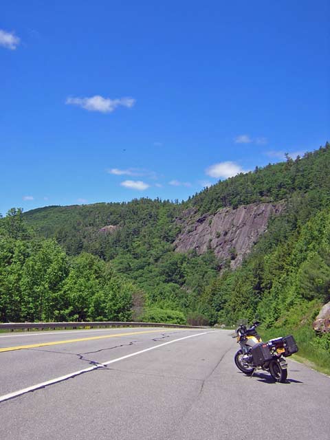
Along route 52 near Megunticook Lake
Not far up the road from this last picture, we were stopped for a bit due to a wreck (turned out to be very mild, but the cars weren'r able to get out of the road themselves). I guess there's worse place to be stuck behind a wreck cleanup than next to a nice lake on a nice day.
Mt. Washington tomorrow assuming the weather cooperates. That's all for today.
Day 13 - June 22, 2006
Long day, early departure, very late return. Full report tomorrow Meanwhile, a teaser pic of the Mt. Washington Auto Road
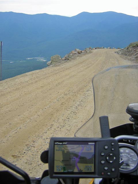
Day 13 - June 22, 2006
Departure time: 0500
Departure City: Union, Maine
Departure Mileage: 4132.2
Arrival time: 2200
Arrival City: Union, Maine
Arrival mileage: 4419.1
Day 13 mileage: 286.9
Click here for a Google Map showing my progress to date
With the forecast of rain and/or thundershowers for Mount Washington for Wednesday morning and early afternoon, and the weather at my folks' house looking decidedly sketchy as well, I decided to strike out very early and try to get to the Mt. Washington Auto Road just as it opened at 7:30 am. By 5:00 here it's pretty light out, although on this day the fog was settling here and there and there was a low overcast, so it wasn't as light as it should have been. I was up, out the door and underway at just about 5:00 on the nose.
The ride is roughly 2 hours and 15 minutes over the back roads through Augusta, North Turner, Bethel and Gilead, ME and Gorham, NH. I stopped for gas in Gorham, then went down the street for some cash from the local ATM and then headed south on 16a to the Auto Road, arriving at 7:35. I pulled up in to the lane marked "motorcycles" and stopped. I shut off the bike and walked over to the toll booth, surprising the attendent, who was still making up his daily cash register drawer and hadn't heard me pull up (loud pipes save time??) At any rate, I paid my $12.00, got my official "This Bike Climbed Mt. Washington" sticker, listened to the safety briefing (speed limit's 20 MPH ... OK ... no passing ... OK) that I never recall having been given when I was in a CAR doing this trip, and headed up the mountain.
The weather hadn't quite closed in yet - I could still see the summit from the road, so the clouds were still above the tops of the mountains - and the temperature wasn't all that bad. This early on a weekday I encountered not a single other vehicle on the road other than the Auto Road maintenance and safety crews, so I essentially had the road all to myself - a nice thing when it came to running along the edge of Tuckerman's Ravine where the road is all dirt, slopes slightly TOWARD the ravine and hugs the side of the mountain like a snake. And for those that have never been to the Mt. Washington Auto Road, there are no guardrails ad there's plenty of places in between the little rocks placed alongside the road where a motorcycle would fit perfectly and plunge several hundred feet to the first bounce... Needless to say, this is a portion of the ride where one tends to focus and stay strictly on task.
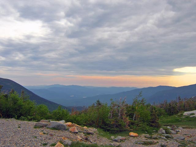
First stop above the timber line looking to the east at what was left of the sunrise.
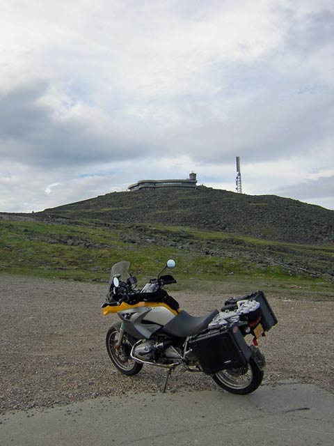
First view of the summit buildings and observatory
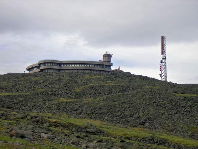
A closer look at the Sherman Adams building and the Yankee tower
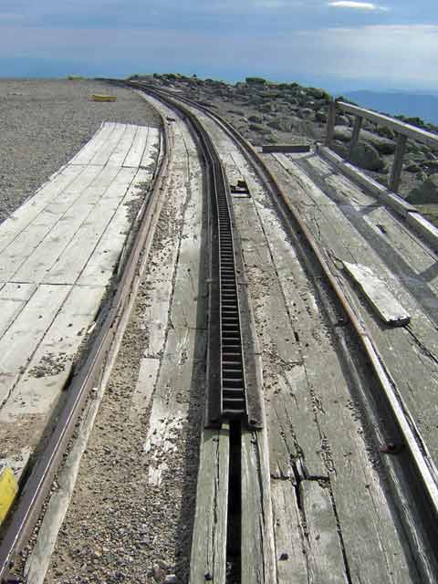
After coming up from the parking area, the first thing you cross is the top of the cog railway that comes up from Bretton Woods, NH.
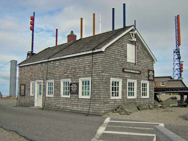
The old stage office and former weather observatory. It's now a hiker's souveneir shop, office for the Cog railway and communications shelter. The fiberglass tubes sticking out of the roof each hold a single radio antenna mounted inside the building, bolted to the attic rafters. The tubes for radomes so the antennas won't be damaged by flying rhime ise in the winter.
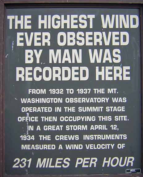
A sign on the side of the old stage office
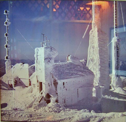
Framed photo inside the Adams building showing the old WMTW site in winter back in the 60's. If I remember to post them when I get home, I've got actual photos I shot on the summit in January of 1991 when I was up there doing a survey for a possible new transmitter site for the station I was working for at the time.
I had breakfast at the snack bar in the Adams building and spent some more time hiking around the summit, looking at the views and the old TV transmitter building that burned down a few years ago and is in the process of being demolished.

Panorama from just above the parking lot looking south and east.
The top of Mount Washington, being the highest point in the northeastern United States is, as you can imagine, a popular place for communications sites. The Yankee Building is the primary location now for both broadcast radio stations, microwave and two-way sites.
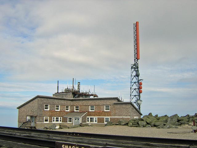
The Yankee Building and tower. The building was built in 1941 and was used for radio broadcasting from 1941 to 1948. In 1948 it was leased by the US Air Force for cold weather jet aircraft engine research. It went back to being a communications site several years later.
The weather was starting to get a bit darker after I had spent an hour on the summit. Thunderstorms were heading in from the west and were due to hit within an hour or two. It was time to make the decision to either go back down or wait out the lightning inside the Adams building. I packed up and headed down.
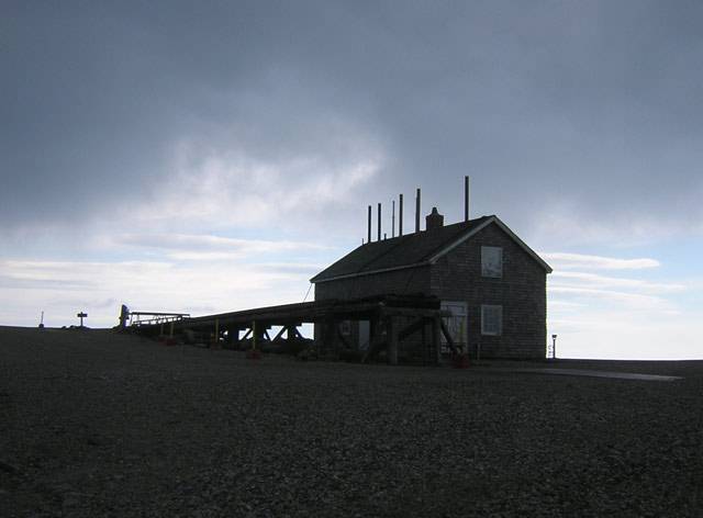
The stage office and the top of the Cog Railway in the lowering scud.
There are several areas on the down trip where once again, you're on the outside of the road, next to the Tuckerman's dropoff and wanting to stay fairly far to the left - of course, this is the point in my down trip that seeming all the stages, dumptrucks and tourist cars were coming up.
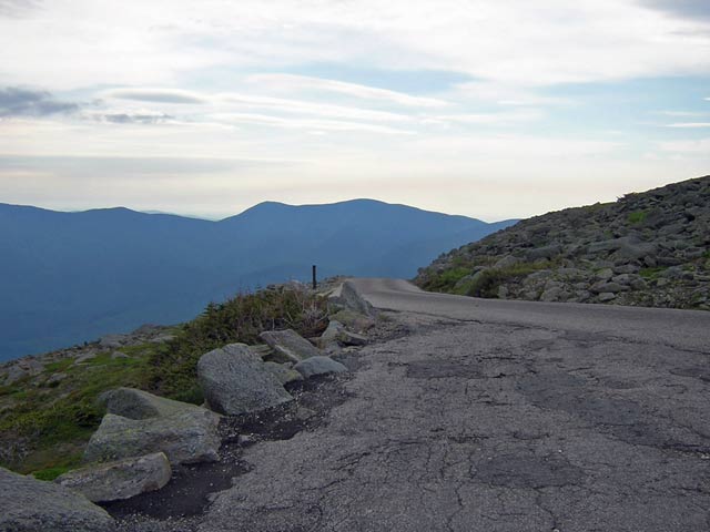
Just below the summit on the way down
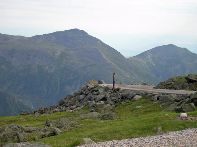
A bit farther down the road near the 5000 foot marker
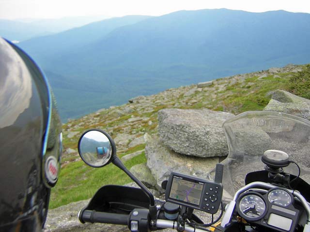
Just before the Tuckerman's Ravine turn looking east
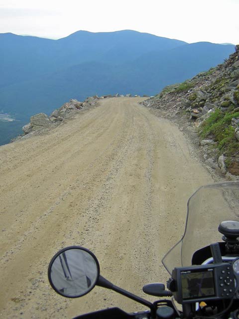
Just entering the section next to Tuckerman's Ravine. Obviously, I didn't stop to take pictures on that section...
I reached the base again around 10:00 and headed south toward Portland for dinner with my friend Roy and his wife Leslie. On the way, I stopped in North Conway for a proper breakfast (other than the coffee and muffin I had on the summit) and then stopped in Yarmouth, Maine to visit with my firends Hal and Fran. After that visit, I discovered that my headlight lamp had burned out, so I switched on the high beam and headed for the nearest NAPA store to pick up a couple of lamps - one for spare.
After dinner and visiting time, I left Portland around 8:30 and arrived back at mom and dad's house at just about 10:00 on the nose - watching the whole way for deer and other critters of the night.
I managed to avoid all of the rain showers and thunderstorms, although it did rain a bit while I was visiting in Yarmouth - so, oddly enough, that marks the 12th day out of 13 that I've not been rained on while riding. For a guy who lives in Oregon, that's just plain strange. It looks like the next few days are going to be quite wet around here though, so I'll feel more at home.
More later.
Day 14 - June 23, 2006
Non-riding relaxation / chores day
Week two ends with a non-riding day. It was simply a day to visit with family, do some laundry, work on some projects around mom and dad's house and veg a little bit. Tomorrow is likely to be very similar. Sunday is a travel day to visit my aunt and grandfather south of Boston, so that's most likely the next day I'll do a report for.
Go on to week three
GO BACK to "Bikestuff" home
A few links
BMW Motorrad | Ducati Motorcycles | Ducati.ms Motorcycle Forum | Sport Touring Net | Adventure RiderSHOEI Helmets | Vanson Leathers | Aerostich Suits